The MOHID Community
In order to present the modelling sites where the MOHID modelling system has been applied and the institutions using it, a Google map has been developed and is open for collaboration.
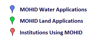
At the moment, three different pointers are shown:
If you use MOHID and want to collaborate adding your application site or your institution please send us an email to applications@mohid.com
For adding an application, whether of MOHID Water or MOHID Land, place the corresponding flag in the study location. At this stage, only study cases with available extra information as publications are to be added. The fields needed to be filled are:
- Study site: i.e. Óbidos Lagoon
- Application or study title: i.e. Óbidos lagoon and Foz do Arelho submarine outfall monitoring program.
- Application creators: Name of the researcher (Name of the institution)
- Related publications: Santos, M., Leitão, P.C., Silva, A., Neves, R. Effect of coastal waves over the sea level in Óbidos Lagoon: a downscaling approach. Continental Shelf Research (Submitted).
- Related Webpages: aplication url i.e. http://www.mohid.com
- Contact person email address: contact email of the application responsible
- Optionally, it should be added an image of the study site application.
For institutions, these are the fields needed to be completed:
- Short institution/company/university name
- Name of the Institution: Full name of the institution/company
- Related Webpages: i.e. http://www.mohid.pt
- Email: Contact email
- Address: Av. Manuel da Maia nº 36 3ºEsq., 1000-201 Lisbon Portugal
- Telephone: +351 xxxxxxxxx
- logo of the institution/company/university
For any doubt or additional info please contact to applications@mohid.com